Shop
 Grade workbooks


Classroom · Geography · 3rd to 5th grade
worksheets
Clear maps of the United States to print: a blank map, a map with every state name, a map with the two-letter abbreviations, a quiz with the states numbered 1 to 50, and the five regions to color. Every map shows all 50 states, with Alaska and Hawaii.
Maps of the United States
 Maps of the United States
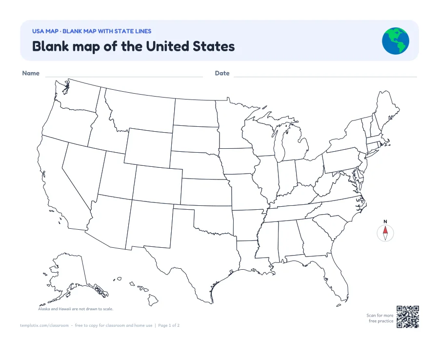
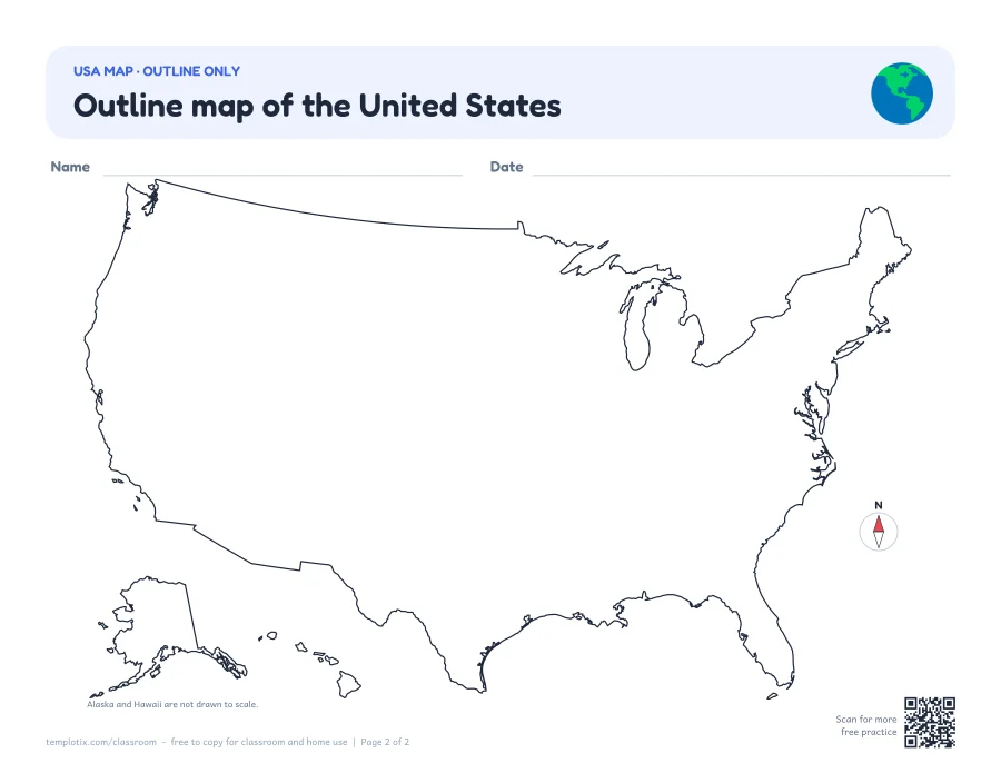 Blank USA mapA blank map of the United States with every state outlined, and a second map with the outline of the country only. Use them to label, color or quiz.
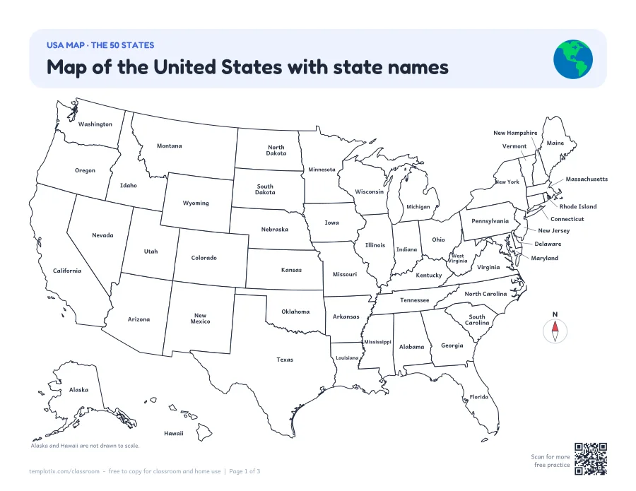
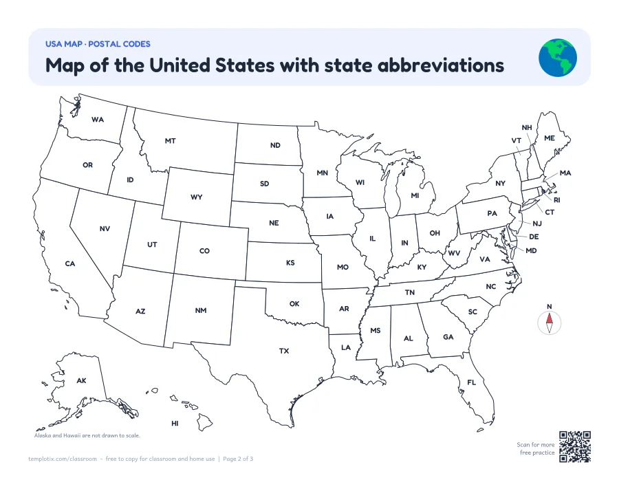 USA map with state namesA map with the name of every state, a second map with the two-letter postal codes, and a key that lists all 50 states with their codes.
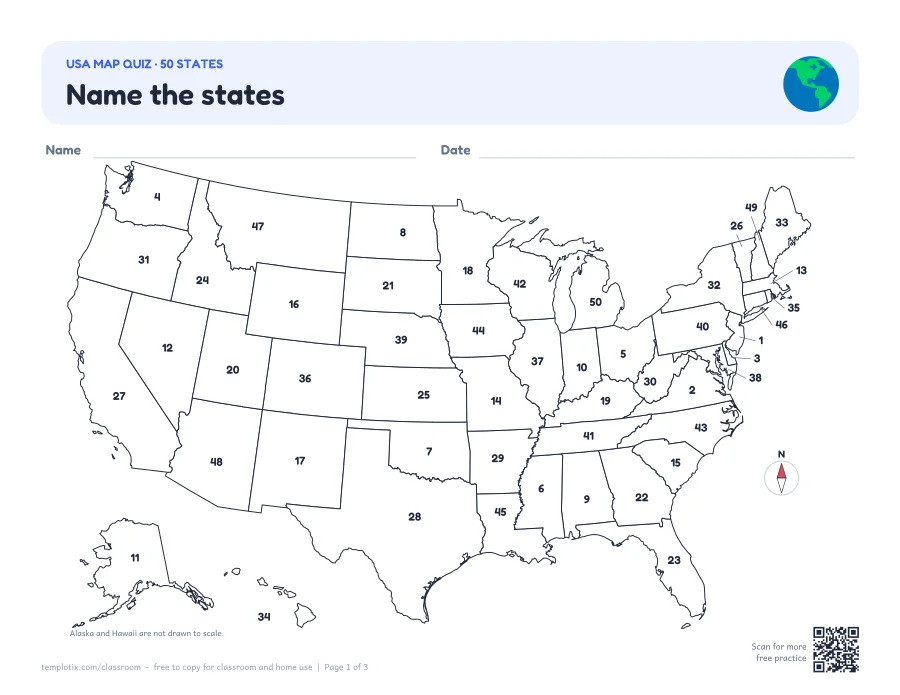
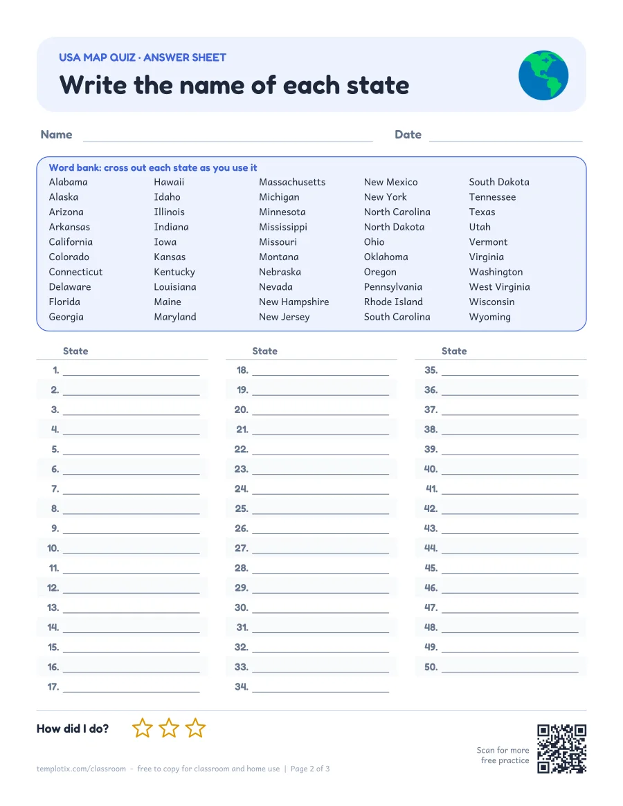 USA map quiz: name the 50 statesA map with the states numbered 1 to 50, an answer sheet with a word bank, and the answer key.
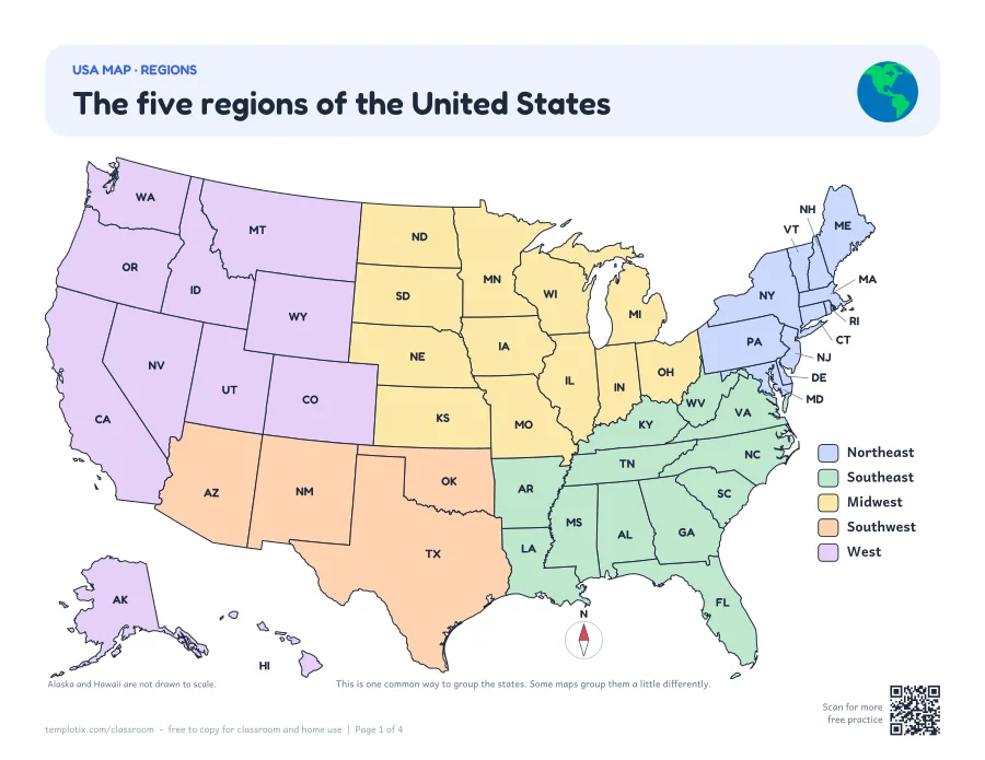
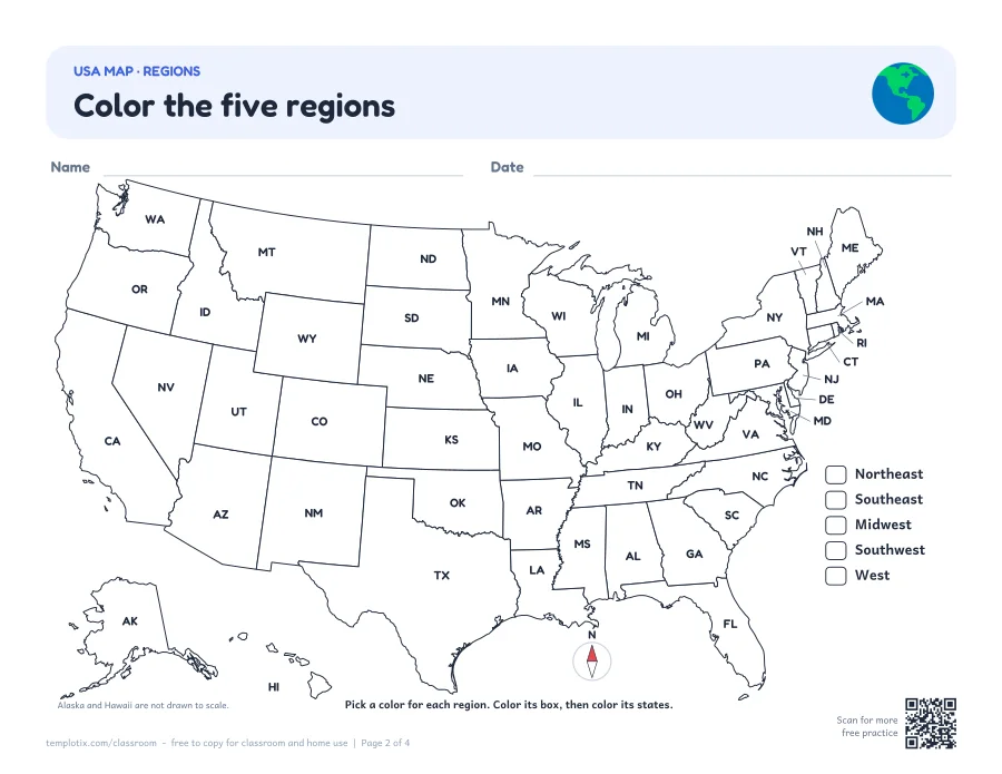 US regions mapThe five regions in color (Northeast, Southeast, Midwest, Southwest and West), a map to color by region, and a worksheet with its answer key.
 Blank USA map
 USA map with state names
 USA map quiz: name the 50 states
 US regions map
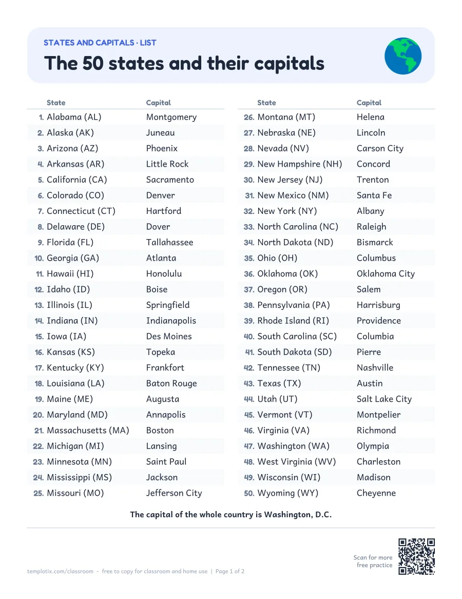 States and capitals worksheetsA one-page list of the 50 states and their capitals, a write-the-capital quiz, and a worksheet for each region with a map up close: Northeast, Southeast, Midwest, Southwest, West.Open states and capitals
The five regions
 The five regions
The regions map and the region worksheets group the 50 states this way.
Northeast (11 states)
Connecticut, Delaware, Maine, Maryland, Massachusetts, New Hampshire, New Jersey, New York, Pennsylvania, Rhode Island, Vermont
Southeast (12 states)
Alabama, Arkansas, Florida, Georgia, Kentucky, Louisiana, Mississippi, North Carolina, South Carolina, Tennessee, Virginia, West Virginia
Midwest (12 states)
Illinois, Indiana, Iowa, Kansas, Michigan, Minnesota, Missouri, Nebraska, North Dakota, Ohio, South Dakota, Wisconsin
Southwest (4 states)
Arizona, New Mexico, Oklahoma, Texas
West (11 states)
Alaska, California, Colorado, Hawaii, Idaho, Montana, Nevada, Oregon, Utah, Washington, Wyoming
Ways to use the blank map
- Find your own state and color it. Then color the states that touch it.
- Label five states a day until the map is full.
- Color the states you have visited, or the states where family lives.
- Draw the big rivers, lakes or mountains you are learning about.
Tips for learning the states
 Tips for learning the states
- Learn one region at a time. Start with the region you live in.
- Look for shapes: Florida and Michigan are easy to spot, and four states meet at one corner in the Southwest.
- Take the quiz with the word bank first, then again with the word bank folded back.
Common questions
How many states are on the map?
All 50. Alaska and Hawaii are drawn in the bottom left corner so that they fit on the page. They are not drawn to the same scale as the other 48 states: Alaska is really more than twice the size of Texas.
What are the five regions of the United States?
These pages use the five regions taught in most elementary schools: the Northeast, the Southeast, the Midwest, the Southwest and the West. Some books group a few states differently (Delaware and Maryland, for example), so check which grouping your class uses.
How does the map quiz work?
Every state on the quiz map has a number from 1 to 50. Children write the name of each state next to its number on the answer sheet, using the word bank if they need it. The last page is the answer key.
What grade are these map worksheets for?
Mostly 3rd to 5th grade, when children study the states. The blank map and the map with state names also work for younger children who are coloring or finding their own state.
How do I print the maps?
The maps are landscape pages (the long side at the top), on US Letter paper. Most printers turn the page by themselves. Choose "Fit" or 100% in the print window. Each PDF also comes as a black-and-white ink saver.
Are the worksheets free?
Yes. Every PDF is free to print and photocopy for classroom and home use.
States and capitals worksheetsWord searchesColoring pagesScience worksheetsAll worksheets
State outlines: U.S. Census Bureau cartographic boundary files (public domain), via us-atlas (ISC license).